Project 01 — Featured
Coastal urban region
20,000² blocks — Compbuild

A coastal region, planned like a real place.

Alaire

Scroll ↓
Downtown Alaire — aerial skyline
Downtown Alaire — aerial view Fig. 01
Overview

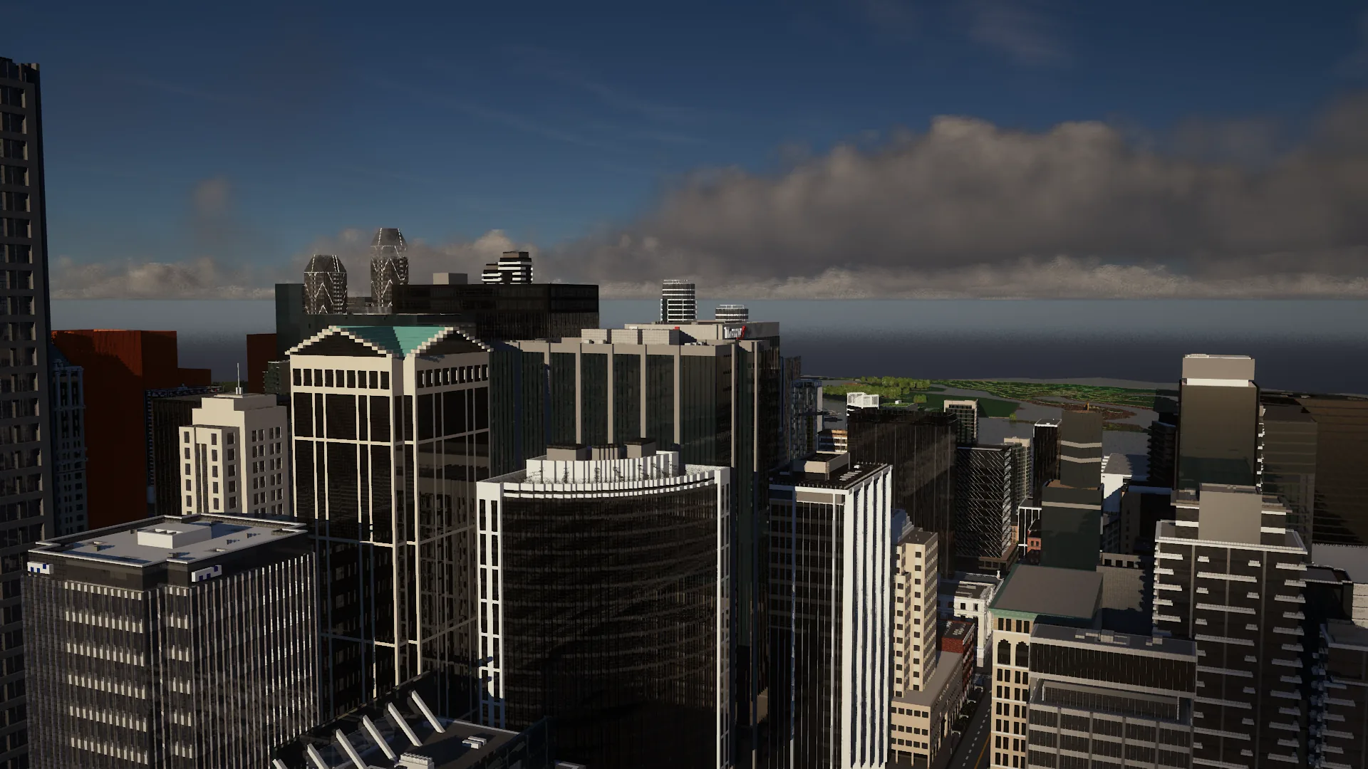
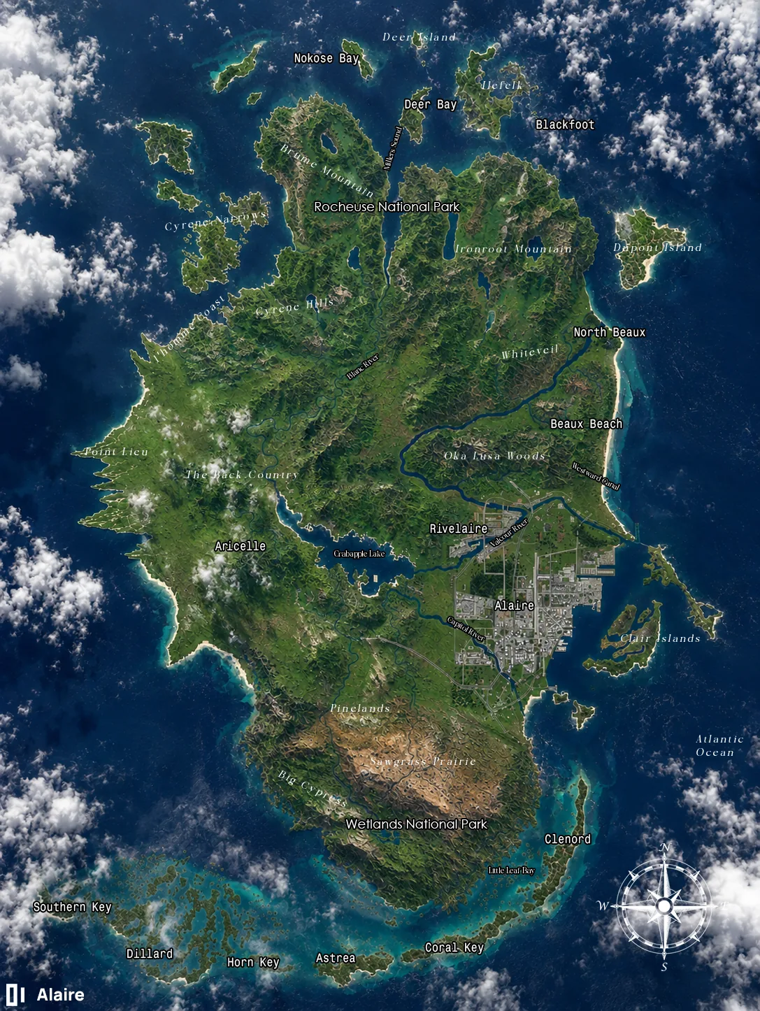
Alaire is a coastal urban region defined by environmental constraints, historical layering, and a deliberate spatial hierarchy. It is not a uniformly dense city, but a structured system where development responds to geography, infrastructure, and long-term planning intent.

Alaire — full territorial satellite map
Alaire — territorial map Urban core
Layer 01

The urban core

The city of Alaire functions as the primary urban core, anchored by its dense center, river systems, and transit infrastructure — the highest concentration of intensity in the region.

Layer 02

Secondary network

Surrounding the core is a network of secondary districts, transitional towns, and geographically distinct regions serving complementary residential, economic, cultural, and logistical roles.

Layer 03

Preserved boundaries

Wetlands, highlands, interior back country, and offshore zones are intentionally preserved or restricted — forming permanent boundaries to urban expansion.

A named territory

Every district, reserve, and waterway is mapped and named
Alaire  ·  Rivelaire  ·  North Beaux  ·  Beaux Beach  ·  Clenord  ·  Aricelle  ·  Point Lieu  ·  
Rocheuse National Park  ·  Ironroot Mountain  ·  Brume Mountain  ·  Cyrene Hills  ·  Oka Lusa Woods  ·  The Back Country  ·  
Deer Island  ·  Dupont Island  ·  Clair Islands  ·  Southern Key  ·  Coral Key  ·  Wetlands National Park  ·  Pinelands  ·  
01

Geography

01 / 05
Urban districts
The developed core and its coastal satellites.

Restricted territory

Permanent boundaries
[ wetlands ]
Wetlands

Tidal margins and estuary systems held as ecological buffer.

[ highlands ]
Highlands

Elevated terrain constraining the northern growth edge.

[ interior back country ]
Interior back country

Low-intensity interior reserved against sprawl.

[ offshore zones ]
Offshore zones

Coastal waters and islands outside the development line.

Historical phases

01 / 04
[ phase 01 — settlement ]
IEarly settlement

Origins as a coastal landing — the first settlement grid anchored to the river mouth and natural harbor.

[ phase 02 — port industry ]
IIPort industrialization

Port-driven growth — warehousing, rail, and industry shaped the working waterfront and its dense grid.

[ phase 03 — vertical growth ]
IIIModern vertical growth

Vertical density in the core — towers, transit, and infill replacing low-rise industrial fabric.

[ phase 04 — consolidation ]
IVPlanned consolidation

Deliberate consolidation — preservation, density allocation, and infrastructure guided by long-term intent.

0
Blocks per edge
0
Historical phases
0
Spatial layers
0
Preserved zones